Vintage Maritime Chart London Map River Thames Tilbury To Margaret Ness Sea

Sold by pickclickandbuy
This seller has received 1,013 ratings (100.00% Positive)
Buy now for $16.00 GBP
Item ships from United Kingdom
Browse all: Europe Maps
Similar Items

$22.40 GBP Buy It Now
Vintage Maritime Chart London Thames Canvey Island to Tilbury sea map 41 X 28cm

$8.70 GBP Buy It Now
ADMIRALTY SEA CHART. No. 1827. HARBOURS on the SOUTH-EAST COAST of ENGLAND. 1987


$8.70 GBP Buy It Now
RIVER THAMES Route through Walton on Thames to Sunbury, Surrey Antique Map 1878


$8.70 GBP Buy It Now
RIVER THAMES Burcott, Dorchester, and Shillingford Oxfordshire Antique Map 1878


More from pickclickandbuy


$18.00 GBP Buy It Now
Vintage Maritime Routeing Chart North Atlantic July (7) sailing navigation map (314741938501)

$18.00 GBP Buy It Now
Vintage Maritime Chart London Thames Canvey Island to Tilbury sea map 41 X 28cm (314825030359)

$9.00 GBP Buy It Now
USAF Vintage Pilotage USA Air Force Chart 1967 Military Flying Map Europe (315097355590)

$12.00 GBP Buy It Now
Vintage Maritime Chart Denmark Alborg Norresundby Nautical Sailing Sea map (314900754012)

$12.00 GBP Buy It Now
Vintage Maritime Chart Germany Denmark Borkum to Helgoland Nautical Sailing map (315126794838)

$12.00 GBP Buy It Now
Vintage Maritime Chart sea map Lanion Erquy Guernsey Sark Cadquets France 2668 (314742879878)

$12.00 GBP Buy It Now
Vintage Maritime Chart Denmark Smalandsfarvandet Vestlige Nautical Sailing map (314900871040)

$12.00 GBP Buy It Now
Vintage Maritime Chart sea map France Pte De La Coubre Pointer D'arcachon 2664 (314742903971)

$12.00 GBP Buy It Now
WW2 Forfar Dundee Scotland Vintage Military map World War office edition 1940 2 (315097374244)

$12.00 GBP Buy It Now
Vintage Maritime Chart Copenhagen Road Denmark Kobenhavns Nautical Sailing map (314900745090)

$12.00 GBP Buy It Now
Vintage Maritime Chart Bornholm Ronne Christianso Denmark Nautical Sailing map (314900834977)

$12.00 GBP Buy It Now
Vintage Maritime Chart sea map 126 Denmark Straits Sundet Og Baelterne Danish (314852633315)

$12.00 GBP Buy It Now
Vintage Maritime Chart Copenhagen Port Of Denmark Amager Nautical Sailing map (314900918982)

$7.00 GBP Buy It Now
London Theatres Cinemas 1955 Original vintage map wall art picture display (313803303050)

$14.00 GBP Buy It Now
Vintage Maritime Chart sea map approaches to Plymouth Devon sailing 1900 pic (314744875821)

$14.00 GBP Buy It Now
Vintage Maritime Chart sea map St Peter Port Guernsey Channel Islands sailing (314742869496)

$14.00 GBP Buy It Now
Vintage Maritime Chart sea map Prawle point Hengistbury head Lyme Regis Poole (314742808374)

$14.00 GBP Buy It Now
Folio Hydrographic maps Netherlands 1810 Nautical Sea Charts Holland Dutch (314852649335)

$14.00 GBP Buy It Now
Vintage Maritime Chart sea map Dover Beachy Head Fecamp Cap Gris- Nez France (314742802808)

$14.00 GBP Buy It Now
Vintage Maritime Chart sea map Eastern Solent Nab tower spithead Isle of Wight (314742790450)

$14.00 GBP Buy It Now
Vintage Map Maritime nautical Chart Great Yarmouth Lowestoft Norfolk Broads (314828717867)

$14.00 GBP Buy It Now
Vintage Maritime Chart sea map Dover Strait Folkestone Calais Bologne France GB (314741869211)

$13.00 GBP Buy It Now
Vintage Maritime Chart sea navigation map Bourgneuf Ile de Groix France 2646 (314748048055)

$13.00 GBP Buy It Now
Vintage Military Map Forth Clyde Tay Glasgow War office edition 1948 OS Scotland (315126983463)

$13.00 GBP Buy It Now
Vintage Maritime Chart Denmark Grådyb Esbjerg Nautical Navigational Sailing map (314839565473)

$13.00 GBP Buy It Now
Vintage Maritime Chart Denmark Horsens Fjord Nautical Navigational Sailing map (314839753311)

$13.00 GBP Buy It Now
Vintage Maritime Chart Denmark Nakskov Fjord Nautical Navigational Sailing map (314839785460)

$13.00 GBP Buy It Now
Vintage Maritime Chart Denmark Kolding Fjord Lille Baelt Nautical Sailing map (314839863819)

$13.00 GBP Buy It Now
Vintage Maritime Chart Denmark Kattegat Sjaelllands Nautical Sailing map (314839826986)

$13.00 GBP Buy It Now
Vintage Maritime Chart Denmark Nordsøen Jyands Vestkyst Nautical Sailing map (314839852033)

$13.00 GBP Buy It Now
Vintage Maritime Chart Vejle Ford Denmark map Sailing Navigation Wall display (314839499796)

$13.00 GBP Buy It Now
Vintage Maritime Chart sea navigation map West Coast France les Sables d'olonne (314748002005)

$13.00 GBP Buy It Now
Vintage Maritime Chart sea navigation map Jersey St Helier Harbour channel 3278 (314748244538)

$13.00 GBP Buy It Now
Vintage Maritime Chart sea navigation map Rade De Best West Coast France 3427 (314748417596)

$13.00 GBP Buy It Now
Vintage Maritime Chart Denmark Lille Baelt Little Belt Nautical Sailing map (314839813144)

$13.00 GBP Buy It Now
Vintage Maritime Chart Denmark Nautical map Store Baelt Sprogo Langeland 143 (314839470408)

$13.00 GBP Buy It Now
Vintage Maritime Chart sea navigation map Ile de Groix to Raz de sein France (314748041527)

$13.00 GBP Buy It Now
Vintage Maritime Chart sea navigation map Pertuis D'antioche 2746 NW France (314748017076)

$13.00 GBP Buy It Now
Vintage Maritime Chart London Newcastle France Belgium Denmark Nautical map 2182 (314839456296)

$13.00 GBP Buy It Now
Vintage Maritime Chart Germany Sundet Og Baelterne Nautical Navigational map (314839582774)

$13.00 GBP Buy It Now
Vintage Maritime Chart sea navigation map Approache to La Loire St Nazaire 3216 (314748388444)

$15.00 GBP Buy It Now
Vintage Military map Teesdale War office edition 1949 Ordnance Survey England (314487574537)

$15.00 GBP Buy It Now
Perth & Stath Earn Vintage Military map War office edition 1948 Scotland (314487638660)

$15.00 GBP Buy It Now
Vintage Military map Elgin & Keith War office edition 1949 Ordnance Survey Scot (314487519425)

$15.00 GBP Buy It Now
Vintage Military map Elgin & Keith War office edition 1949 Ordnance Survey Scot (314487560235)

$15.00 GBP Buy It Now
Loch Katrine & Loch Earn Vintage Military map War office edition 1949 Scotland (314487629095)

$15.00 GBP Buy It Now
Vintage Military map Hawick & Eskdale Scotland War office edition 1947 OS (314487481767)

$15.00 GBP Buy It Now
Vintage Maritime Chart sea navigation map Raz de Seine Goulven 2643 NW France (314747989223)

$15.00 GBP Buy It Now
WW2 Aalborg Vintage Military map War office edition 1944 Ordnance Survey (314958053265)

$15.00 GBP Buy It Now
Scarborough WW11 Vintage Military map War office edition 1940 England World War (314487582818)

$16.00 GBP Buy It Now
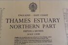
Vintage Maritime Chart London Thames Estuary Northern Part Walton On the Naze (314828747599)


Whohou Marketplace | Terms of Use | Privacy Policy | Contact Us | Follow us on Facebook, Instagram, and Twitter | Affiliate Program | Affiliate Portal