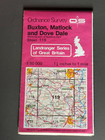
Os, Ordnance Survey Landranger Map No: 119, Buxton & Matlock

Sold by limehound
This seller has received 10,123 ratings (99.90% Positive)
Buy now for $2.60 GBP
Item ships from United Kingdom
Browse all: Maps & Atlases
Similar Items


More from limehound


$7.50 GBP Buy It Now
Great People of the Past, The Mesoamericans, National Geographic, Map & Poster (374552663295)


$7.50 GBP Buy It Now
Millennium in Maps, Exploration, National Geographic, Map & Poster, 1998 (374758957776)


$4.80 GBP Buy It Now
OS Ordnance Survey, Pathfinder Map, Sheet: 631 Bedale & Pickhill (375961430167)


$4.80 GBP Buy It Now
OS Ordnance Survey, Pathfinder Map, Sheet: 575 Cockermouth & Maryport (375959767513)

$4.80 GBP Buy It Now
OS Ordnance Survey, Pathfinder Map, Sheet: 546 Haltwhistle & Gilsland (375959746037)


$4.80 GBP Buy It Now
OS Ordnance Survey, Pathfinder Map, Sheet: 758 Northwich & Knutsford (375960093336)

$4.80 GBP Buy It Now
OS Ordnance Survey, Pathfinder Map, Sheet: 637 Burton-in-Kendal & Caton (375961435476)

$4.80 GBP Buy It Now
OS Ordnance Survey, Pathfinder Map, Sheet: 703 Wakefield ( South ) (375960092604)


$4.80 GBP Buy It Now
OS Ordnance Survey, Pathfinder Map, Sheet: 108 Scalpay ( Harris ) (375961651188)


$4.80 GBP Buy It Now
OS Ordnance Survey, Pathfinder Map, Sheet:33 Stromness & Old Man of Hoy (375961817027)


$4.80 GBP Buy It Now
OS Ordnance Survey, Pathfinder Map, Sheet: 741 Stockport ( South )_ (375960095261)

$4.80 GBP Buy It Now
OS Ordnance Survey, Pathfinder Map, Sheet: 134 Cromarty & Balintore (375961646203)

$4.80 GBP Buy It Now
OS Ordnance Survey, Pathfinder Map, Sheet:759 Macclesfield and Alderley Edge (375960810094)

$4.80 GBP Buy It Now
OS Ordnance Survey, Pathfinder Map, Sheet:756 Ellesmere Port ( West ) (375960810680)

$4.80 GBP Buy It Now
OS Ordnance Survey, Pathfinder Map, Sheet: 738 Birkenhead & Liverpool ( South ) (375960175182)


$4.80 GBP Buy It Now
OS Ordnance Survey, Pathfinder Map, Sheet:593 Whitehaven & St Bees (375960812832)


$4.80 GBP Buy It Now
OS Ordnance Survey, Pathfinder Map, Sheet: 647 Barrow-in-Furness ( South ) (375959269580)

$4.80 GBP Buy It Now
OS Ordnance Survey, Pathfinder Map, Sheet: 86 Strath of Kildonan (375961811709)


$4.80 GBP Buy It Now
OS Ordnance Survey, Pathfinder Map, Sheet: 626 Broughton in Furness & Newby B (375961434992)

$4.80 GBP Buy It Now
OS Ordnance Survey, Pathfinder Map, Sheet: 547 Hexham & Haydon Bridge (375959746824)


$4.80 GBP Buy It Now
OS Ordnance Survey, Pathfinder Map, Sheet: 679 Preston ( North ) and Kirkham (375961427483)

$4.20 GBP Buy It Now
OS, Ordnance Survey, Explorer map Sheet 179, Gloucester, Cheltenham & Stroud (375961442796)

$4.20 GBP Buy It Now
OS, Ordnance Survey, Explorer map Sheet 169, Cirencester & Swindon (375961443743)

$4.20 GBP Buy It Now
OS, Ordnance Survey, Explorer map Sheet 288, Bradford & Huddersfield (375961437366)


$4.20 GBP Buy It Now
OS, Ordnance Survey, Explorer map Sheet 181, Chiltern Hills North, Aylesbury (375961437937)


$4.20 GBP Buy It Now
OS, Ordnance Survey, Explorer map Sheet 189 Hereford & Ross-on-Wye (375961440490)

$4.20 GBP Buy It Now
OS, Ordnance Survey, Explorer map Sheet 303, Whitehaven & Workington (375960802354)

$4.20 GBP Buy It Now
OS, Ordnance Survey, Explorer map Sheet 167, Thornbury, Dursley & Yate (375961444473)

$4.20 GBP Buy It Now
OS, Ordnance Survey, Explorer map Sheet 149, Sittingbourne & Faversham (375961442507)

$4.20 GBP Buy It Now
OS, Ordnance Survey, Explorer map Sheet 275, Liverpool, St Helens, Widnes (375960805896)


$4.20 GBP Buy It Now
OS, Ordnance Survey, Explorer map Sheet 315, Carlisle, Brampton,Longtown & Gretn (375961436930)


$4.20 GBP Buy It Now
OS, Ordnance Survey, Explorer map Sheet 253, Lleyn Peninsula West (375961823803)


$4.20 GBP Buy It Now
OS, Ordnance Survey, Explorer map Sheet 277, Manchester & Salford (375961824669)

$4.20 GBP Buy It Now
OS, Ordnance Survey, Explorer map Sheet 147, Severnoaks & Tonbridge (375961825328)


$4.20 GBP Buy It Now
OS, Ordnance Survey, Explorer map Sheet 148 ,Maidstone & The Medway Towns (375961442124)

$4.20 GBP Buy It Now
OS, Ordnance Survey, Explorer map Sheet 170, Abingdon, Wantage & The Vale (375960808242)

$4.20 GBP Buy It Now
OS, Ordnance Survey, Explorer map Sheet 157 Marlborough & Savernake Forest (375961438726)

$4.20 GBP Buy It Now
OS, Ordnance Survey, Explorer map Sheet OL 16, The Cheviot Hills (375958055195)


$4.20 GBP Buy It Now
OS, Ordnance Survey, Explorer map Sheet 206, Edge Hill & Fenny Compton (375960807133)

$19.85 GBP Buy It Now
Vintage Ordnance Survey Coloured One Inch Cloth Map, Manchester, 1913, Sheet 53 (375548712115)


$5.85 GBP Buy It Now
OS Ordnance Survey One Inch Cloth Map, of Strathpeffer, Sheet 27, 1962 (373642563856)

$9.85 GBP Buy It Now
OS, 6 Inch to 1 Mile Map, sheet ST 72 NE, Somerset, Cucklington area, 1962 (373447962677)

$7.85 GBP Buy It Now
Ordnance Survey One Inch War Revision Paper Map, Birmingham, 1940's (375578949496)

$7.85 GBP Buy It Now
Ordnance Survey One Inch MOD Paper Map, Boston & Skegness, sheet 114, 1962 (375556354027)

$7.85 GBP Buy It Now
Ordnance Survey One Inch MOD Paper Map, Northampton, sheet 133, 1962 (375556344593)

$6.50 GBP Buy It Now
Discoverers of the Pacific, National Geographic, Folded Map,1974 (373660551601)

$6.50 GBP Buy It Now
National Geographic, Folded Map,1974, North & South Dakota, Nebraska, Kansas etc (373660460289)


$11.25 GBP Buy It Now
OS, Ordnance Survey, one inch Tourist Map, Ben Nevis & Glen Coe. 1959 (375548943569)

$16.85 GBP Buy It Now
Vintage Ordnance Survey Coloured One Inch Cloth Map, Barmouth, 1910, Sheet 59 (375441621514)

$12.85 GBP Buy It Now
Vintage Ordnance Survey Popular One Inch Cloth Map, Bicester, 1919. No:94 (375441757974)

$12.85 GBP Buy It Now
Vintage Ordnance Survey Popular One Inch Cloth Map, Clacton on Sea, 1929. No:98 (375456723191)


Whohou Marketplace | Terms of Use | Privacy Policy | Contact Us | Follow us on Facebook, Instagram, and Twitter | Affiliate Program | Affiliate Portal